Home Dolomites Summer Seiser Alm Hiking Loop-trail of the Calvary hill in Kastelruth
 Seiser Alm
Loop-trail of the Calvary hill in Kastelruth
Very easy
Circumnavigation of the Kofel in Kastelruth
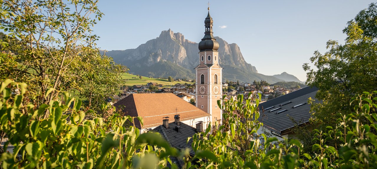
The name Kastelruth derives from the term "Castel Ruptum", which translates to "destroyed castle". Historical documents show that a magnificent fortification once stood on the Castle Hill, also known as the Kofel. By the way, you can also find this hike in the family hiking book "Mein kleines Hexe Nix Wanderheft" (Hike No. 8).
The starting point for this hike is the historic village square of Kastelruth. From here, the trail leads you through the right arch of the current town hall and former residence of the Lords of Kraus towards the Kofel. Along the way, you will pass two chapels until you finally reach the so-called "Kegelplatz". On this route, you will encounter 14 stations with imaginatively painted porphyry slabs that depict symbols and themes of peace. After circling around the Kofel and enjoying a view of the village with its impressive church tower and the Schlern mountain range in the background, you return to the village square.