Home Dolomites Summer Drei Zinnen Hiking Mountain hike: Carnic Alpine Ridgeway (Karnischer Höhenweg)
 Drei Zinnen / Three Peaks
Mountain hike: Carnic Alpine Ridgeway (Karnischer Höhenweg)
Strenuous
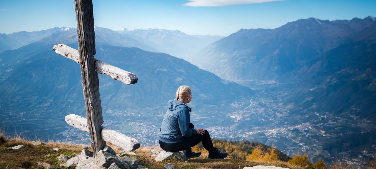
"A very long, but not difficult and scenically spellbinding hike along the Carnic Ridge (Karnischer Kamm).
This well-marked Alpine ridgeway really demands some stamina, as it climbs repeatedly up and down along the ridge, taking in several mountain peaks; here and there you also get to enjoy a pretty little lake. The route offers magnificent views of the mountains of South and East Tyrol, and in particular of the Sexten Dolomites. Along the ridge you will come across many historical traces of the First World War, a military cemetery and various border constructions. The trail is partly in Italy and partly in Austria.
Route: First take the Helm cable car to the mountain station (2,041 m). From there head east past the Hahnspielhütte hut (2,150 m) to the Sillianer Hütte hut (2,447 m) and then over the summit of the Hochgruben (2,537 m), from where you can take a short-cut back down into the valley (see Alternative 1). Trail no. 403 crosses or goes round first the Hornischeck (2,550 m) followed by the peak of the Hollbrucker Spitze (2,581 m) and then the Hochgräntenjoch ridge (2,429 m; here too you can get down to the valley by the military cemetery). Up next come the Demutspitze (2,591 m), the Schöntalhöhe (2,634 m) and the two peaks of the Eisenreich (2,665 m), from where you go down to the Obstanser Sattel saddle (2,533 m) in the west. Here there is a sign pointing to the Obstansersee Hütte mountain hut on the left (2,304 m); at this point you leave the ridge on the right and go on trail no. 160 south-west down to the Kniebergsattel saddle (2,325 m) and from there right again on trail no. 146 to the Nemes Alm Alpine farm (1,877 m, refreshments available). Continue down the valley on trail no. 13 and 139 to the Froneben mountain inn (1,540 m) and so back to Moso/Moos.
Alternative 1: The tour can be shortened after the Sillianer Hütte hut by going down on mountain trail no. 134 and then 133 to the Klammbachalm Alpine farm. From there take trail no. 13 and the Mühlensteig trail or trail no. 139 back to Moso. The walking time is then about 4–5 hours.
Alternative 2 (really lovely): After the Sillianer Hütte hut, continue to the small military cemetery and then go down on trail no. 14 and continue to the Klammbachalm Alpine farm. Then continue as for Alternative 1. Walking time 5–6 hours
This hike offers outstanding 360 degree panoramic views - after the Sillianer Hütte the trail is quite remote and is the perfect location to enjoy some inner peace. If you go down to the Obstansersee Hütte mountain hut, make sure you set off early because you will need to allow at least 45 minutes to get there and back.
Starting point: Sesto/Sexten (1,310 m)
Highest point: 2,650 m
Alternative way up: Helm panoramic cable car"
Starting Point: Parking area Monte Elmo - Cable car Monte Elmo
"A very long, but not difficult and scenically spellbinding hike along the Carnic Ridge (Karnischer Kamm).
This well-marked Alpine ridgeway really demands some stamina, as it climbs repeatedly up and down along the ridge, taking in several mountain peaks; here and there you also get to enjoy a pretty little lake. The route offers magnificent views of the mountains of South and East Tyrol, and in particular of the Sexten Dolomites. Along the ridge you will come across many historical traces of the First World War, a military cemetery and various border constructions. The trail is partly in Italy and partly in Austria.
Route: First take the Helm cable car to the mountain station (2,041 m). From there head east past the Hahnspielhütte hut (2,150 m) to the Sillianer Hütte hut (2,447 m) and then over the summit of the Hochgruben (2,537 m), from where you can take a short-cut back down into the valley (see Alternative 1). Trail no. 403 crosses or goes round first the Hornischeck (2,550 m) followed by the peak of the Hollbrucker Spitze (2,581 m) and then the Hochgräntenjoch ridge (2,429 m; here too you can get down to the valley by the military cemetery). Up next come the Demutspitze (2,591 m), the Schöntalhöhe (2,634 m) and the two peaks of the Eisenreich (2,665 m), from where you go down to the Obstanser Sattel saddle (2,533 m) in the west. Here there is a sign pointing to the Obstansersee Hütte mountain hut on the left (2,304 m); at this point you leave the ridge on the right and go on trail no. 160 south-west down to the Kniebergsattel saddle (2,325 m) and from there right again on trail no. 146 to the Nemes Alm Alpine farm (1,877 m, refreshments available). Continue down the valley on trail no. 13 and 139 to the Froneben mountain inn (1,540 m) and so back to Moso/Moos.
Alternative 1: The tour can be shortened after the Sillianer Hütte hut by going down on mountain trail no. 134 and then 133 to the Klammbachalm Alpine farm. From there take trail no. 13 and the Mühlensteig trail or trail no. 139 back to Moso. The walking time is then about 4–5 hours.
Alternative 2 (really lovely): After the Sillianer Hütte hut, continue to the small military cemetery and then go down on trail no. 14 and continue to the Klammbachalm Alpine farm. Then continue as for Alternative 1. Walking time 5–6 hours
This hike offers outstanding 360 degree panoramic views - after the Sillianer Hütte the trail is quite remote and is the perfect location to enjoy some inner peace. If you go down to the Obstansersee Hütte mountain hut, make sure you set off early because you will need to allow at least 45 minutes to get there and back.
Starting point: Sesto/Sexten (1,310 m)
Highest point: 2,650 m
Alternative way up: Helm panoramic cable car"